AUTOMATED CARTHOGRAPHY AND DIGITAL MAPPING
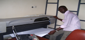 Utilization of computer technology enables NIELSON NIG LTD to produce maps and plans in automated Digital formats. Information is presented in user defined format in full range of industrial standard. We are well experienced in Digitizing logic and technique from
1. Source with a digitizing table
2. Semi-automatic from scanned sources
Digitizing logic and technique from our deliverables are georeferenced data-set corresponding to the target data model.
GEOGRAPHICAL INFORMATION SYSTEM (GIS/GIM)
We provide a comprehensive range of GIS services based on our experience in surveying and mapping coupled with our state-of-the-art equipment, software and specialized staff. We handle application building on Intergraph and ARC INFO/ARC CAD with associated use of ORACLE relational data- base. We also have additional software capabilities to handle the following special applications such as;
- General data format conversions
- Co-ordinate conversions
- Co-ordinate management systems
- Data integrity checkers
MAPS, PLAN
Maps and map related information are significant factors in planning, execution and decision making related to oil & gas 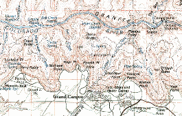 field development and engineering. Developing of natural and environmental resources and utilities all depend on up-to-date comprehensive and reliable maps.